Skip to product information
1 of 4

Old Map of Keswick by Ordnance Survey, 1904 – Derwentwater, Buttermere & Helvellyn

Old Map of Keswick by Ordnance Survey, 1904 – Derwentwater, Buttermere & Helvellyn

Regular price £69.99 GBP
Regular price Sale price £69.99 GBP
Sale Sold out
Taxes included. Shipping calculated at checkout.
Keswick
Size
Frame
  • Framed or unframed
  • Fine-art paper
  • Made to order

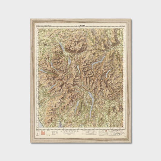
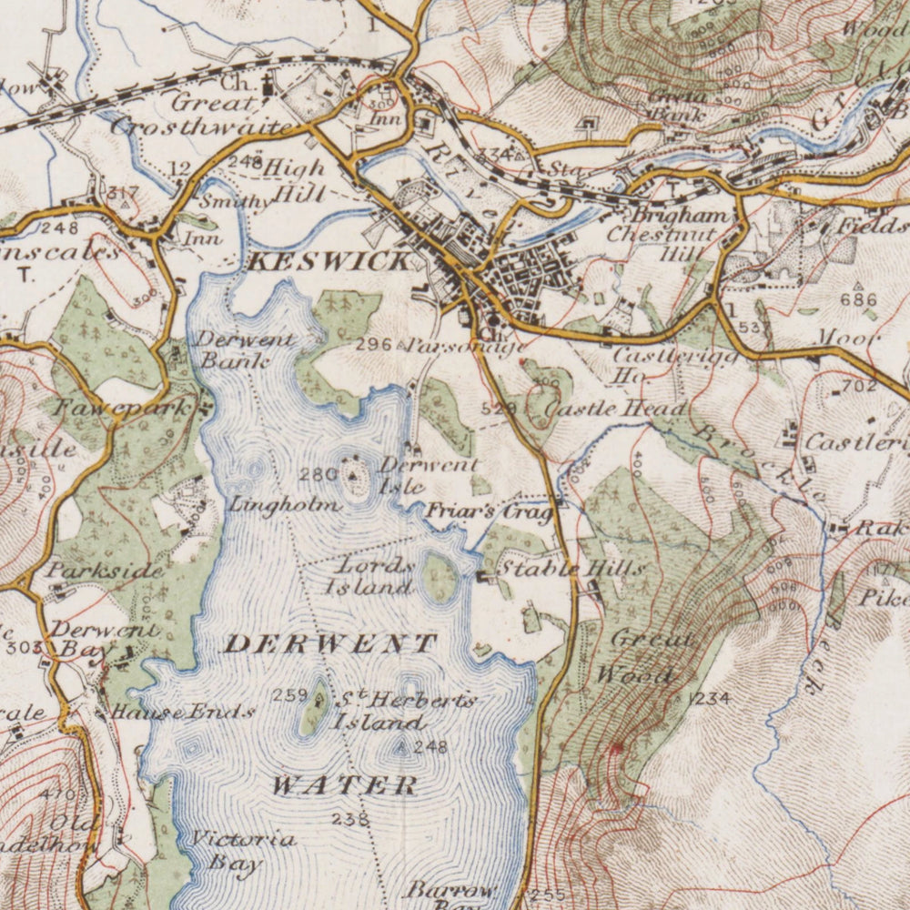
This reproduction print shows the Ordnance Survey’s One-inch Revised New Series, coloured issue from 1904. Originally published as Sheet 29 - Keswick, it captures the dramatic northern fells and valleys of the Lake District at a detailed one-inch-to-the-mile scale.

The sheet features the distinctive brown hill shading of early twentieth-century cartography, bringing the rugged topography into sharp relief. Period lettering marks rural roads before modern development. The eye is drawn across the waters of Derwentwater and Buttermere, tracing the contours eastwards to the high ridges of Helvellyn. Railways of the era are clearly delineated, mapping a landscape for early walkers.

Hung on the wall of a hallway or a cottage sitting room, this map offers a handsome focal point for anyone who knows the fells. You can order it unframed to finish yourself, or delivered ready to hang in a slim, solid wood frame. A black frame particularly complements the deep, earthy tones of the cartography.

Sizes

The sizes offered are the ones this sheet prints sharply at from its own scan — choose above. Each is width × height of the printed sheet.

Framed, the 20 mm moulding sits outside the sheet and there is no mount, so the whole map, margins and all, is on show. Unframed, it is sent flat, ready for a frame of your own.

Paper, frame and glazing

Printed on 200 gsm enhanced matte fine-art paper — no gloss and no glare, so the colouring and the small lettering read cleanly.

Framed in a 20 mm wide, 24 mm deep solid wood moulding in natural wood, black or white, glazed with shatterproof acrylic rather than glass, with a backing board and hanging fixtures already fitted.

Unframed prints are the same paper and the same print, sent flat.

How it is reproduced

Printed from a high-resolution scan of an original copy of the sheet. The lettering, colouring, margins and marks are the map's own: nothing is redrawn. Where the scan needed it, the sheet has been straightened and the tone of the paper evened out.

It is a map of its time, not of today: roads, railways and boundaries are as they were drawn then.

Delivery and returns

Every map is printed and framed to order, at the production facility closest to your delivery address.

Framed pieces are made and dispatched within 5–10 working days. UK delivery normally takes up to five working days after dispatch; international orders can take up to 28 days.

Full detail is in our shipping policy and refund policy.

View full details
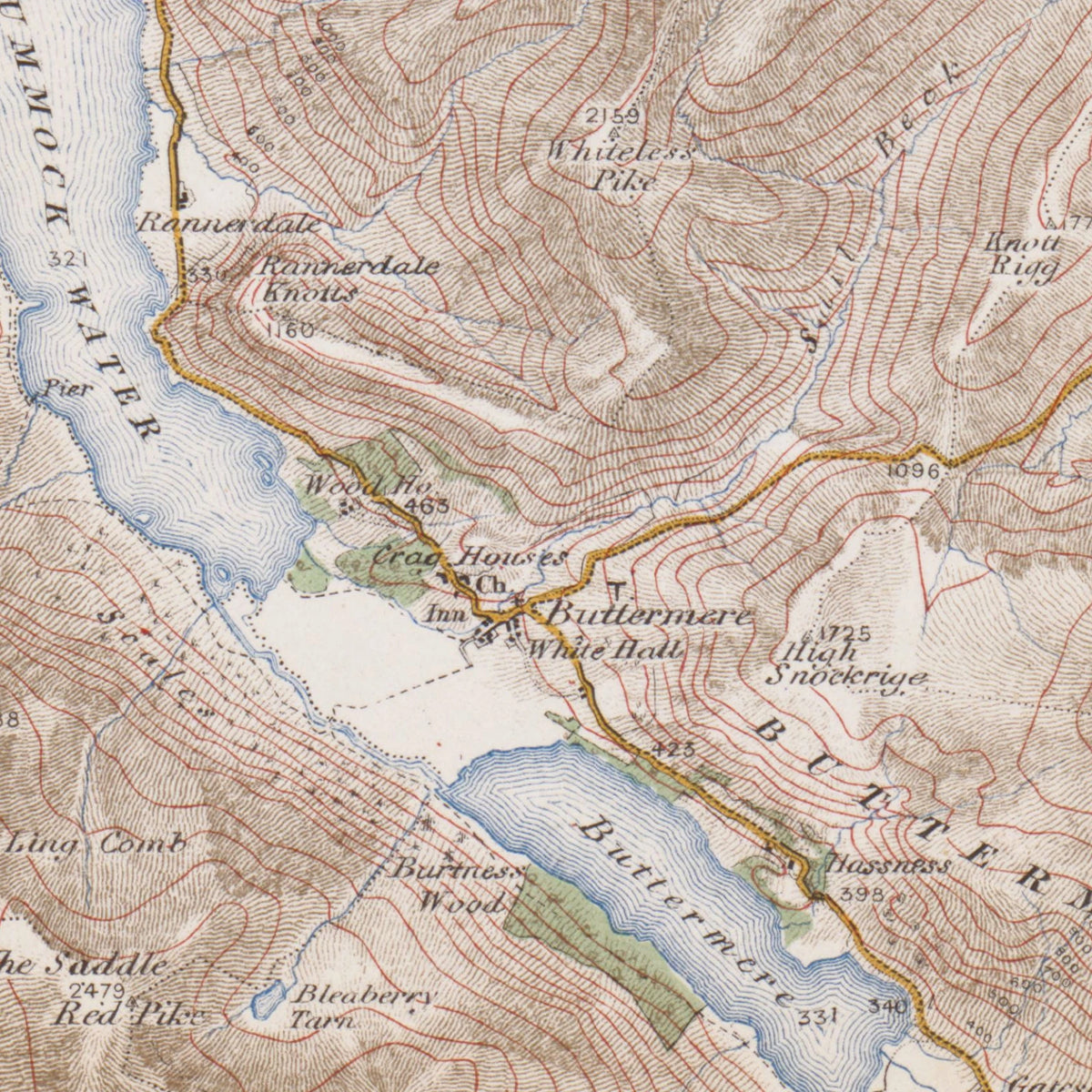
Old Map of Keswick by Ordnance Survey, 1904 – Derwentwater, Buttermere & Helvellyn: close-up of the printed map at full size

A detail of the print at full size.

About this map

The sheet
OS One-inch Revised New Series, coloured issue: Sheet 29 - Keswick
Made by
Ordnance Survey (Crown)
Date
1904

A reproduction of the whole sheet, printed from a high-resolution scan of an original copy: the lettering, colouring and margins are the map's own. The original is long out of copyright. Printed to order on 200gsm matte fine-art paper.

Reproduced with the permission of the National Library of Scotland.

Paintings of Keswick